Long before there were digital Google Maps, Rand McNally road atlases and Michelin fold out maps there was the Forma Urbis Romae, or Marble Plan, an extraordinary plan of every street and building existing in early third-century C.E. Rome. Incised on one hundred fifty marble slabs, the plan was sixty feet wide and forty-three feet high and hung on a wall of the Temple of Peace, now the east façade of the Basilica of Saints Cosmas and Damian on the Via dei Fori Imperiali. Created during the reign of Emperor Septimius Severus (r. 193-211 C.E.), the map was likely used as a decorative element in a building in which Rome’s land records were maintained but was so detailed that the first floor plan of every structure in the city could be identified. As with most of ancient Rome, the marble slabs came tumbling down and now only about fifteen percent of the original map survives in a jigsaw collection of over eleven hundred pieces.


East wall of Basilica of SS. Cosmas and Damian where Marble Plan attached and recreation of interior of Temple of Peace
Many of the broken fragments of the slabs were found in the sixteenth century in a then garden behind the church and were studied and copied in drawings before being used as bric brac fill in a wall for the Farnese garden along the Via Giulia. Occasionally, over the centuries since a few additional pieces would be discovered, and the surviving ones were briefly displayed at the beginning of the twentieth century in the Capitoline Museum before being relegated to storage. Nevertheless, the remaining parts of the Marble Plan have provided a hugely important tool for researchers on Roman topography as well as a source of inspiration for artists such as Piranesi who often included pieces of the Forma Urbis Romae in his prints.
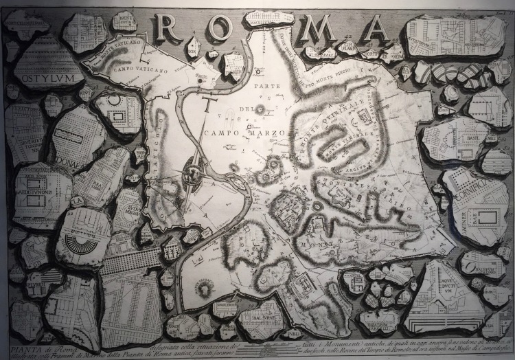 G.B. Piranesi, Pianta di Roma, 1756
Recently, however, a new fragment turned up in excavations under the Palazzo Maffei Marescotti on the Via della Pigna in the area behind the Pantheon and is now on view through March 17 at the Museo dell’Ara Pacis. How the piece ended up so far from its original location is a mystery, but the area of its discovery was used during the Medieval period for burning broken marble in large kilns to be turned into lime for newer construction. Fortunately, this small piece of ancient Rome avoided the ovens.
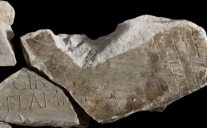 Newly discovered fragment of Forma Urbis Romae (large piece in center)
The section discovered under the palazzo fills in an important missing piece of the map in the area of the Circus Flaminius, now the location of the Via del Portico d’Ottavia and for many centuries Rome’s Ghetto. This was the southern end of the Campus Martius, or Field of Mars, that was once outside of the city proper but by the time of the map’s creation was a vibrant and critical part of Rome’s urban fabric. More likely a public gathering space and market area rather than a “circus” for games such as the Circus Maximus, the Circus Flaminius was flanked by beautiful porticos behind which were temples to Jupiter the Stayer, Juno the Queen and Hercules of the Muses. Triumphal parades for Rome’s greatest generals such as Pompey likely formed up in this area before wending their way through the city gates to the applause and shouts of the crowds. Next to the later constructed Theater of Marcellus, the Circus Flaminius was confined on the southeast side by the massive structure as well as by two more temples to Apollo and Bellona, the ruins of which are still visible. As one scholar, Diane Favro, has noted, the construction of the theater probably forced triumphal parades to move through the theater arcades to fit in the tight space.
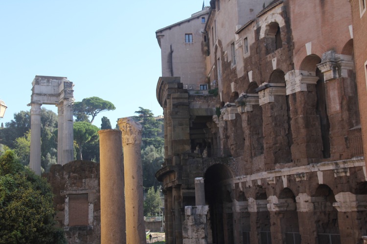 Looking southeast from the “Circus Flaminius” with Theater of Marcellus on right and Temple of Apollo in background
The newly found fragment suggests that by the time of the Severans the space was trimmed even further with structures that opened in the direction of the theater and may have related to the theater as storage or shops for theatergoers. Those buildings would appear to be in the area of Rome’s main synagogue as shown below. The find will add critical information to our snapshot of Rome at the height of the empire and its public display, albeit short, provides a rare opportunity to see a broken but important “piece” of it and should not be missed.
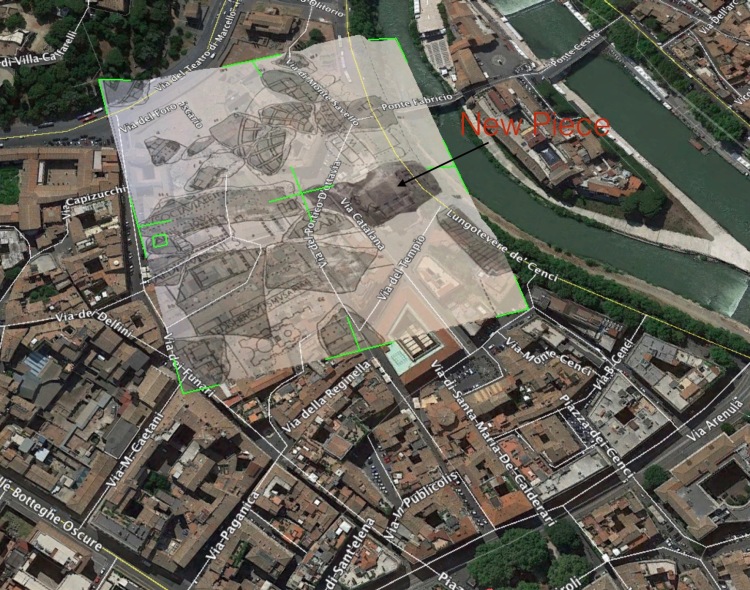 Overlay of drawings of Marble Plan from E. Rodriguez Almeida, Forma Urbis Marmorea (Edizione Quasar 1981) and newly found piece on Google Earth
